
Quick Links:
Watch the Assembly webinar recording.
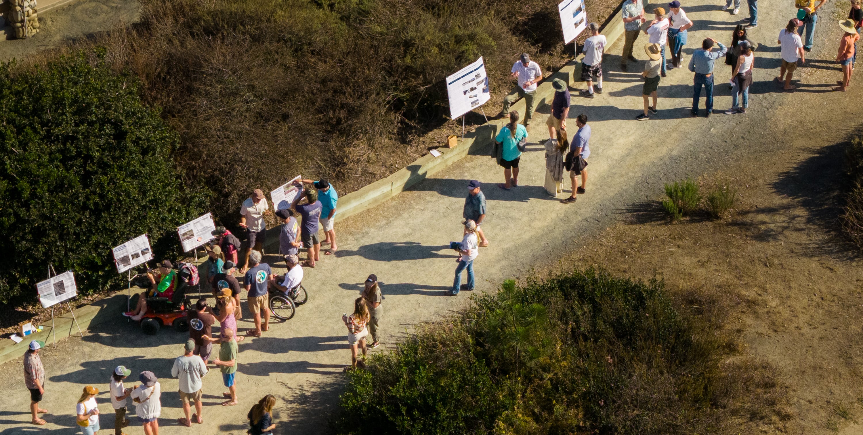
On Sunday, June 14, our San O community gathered once again for Part 2 of the San Onofre Shoreline Resilience Project assembly series. At Assembly Part 1, we provided project framing and background, and asked you high-level questions about how you use and think about Surf Beach. Assembly Part 2 reported what our engineering and survey teams have learned about shoreline conditions since the kickoff of the Project and shared, for the first time, real design concepts for Surf Beach, and asked the community to weigh in.
How Community Members Engaged
After opening words from Juaneño Band of Mission Indians Acjachemen Chairwoman Edmondson, attendees were invited to move through a self-guided gallery walk of five stations, each covering a different component of the project: a read back of community input to date, big picture design alternatives, and urgent questions about parking and access in the near-term while the long-term project is developed.
Take a Virtual Tour
What We Heard:
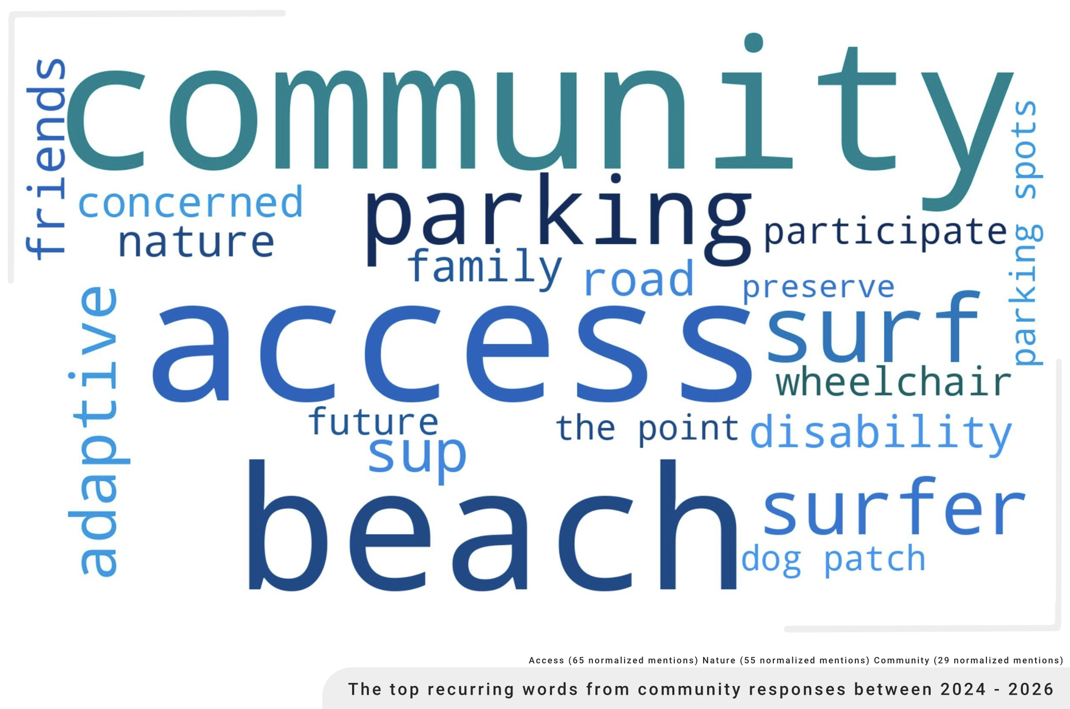
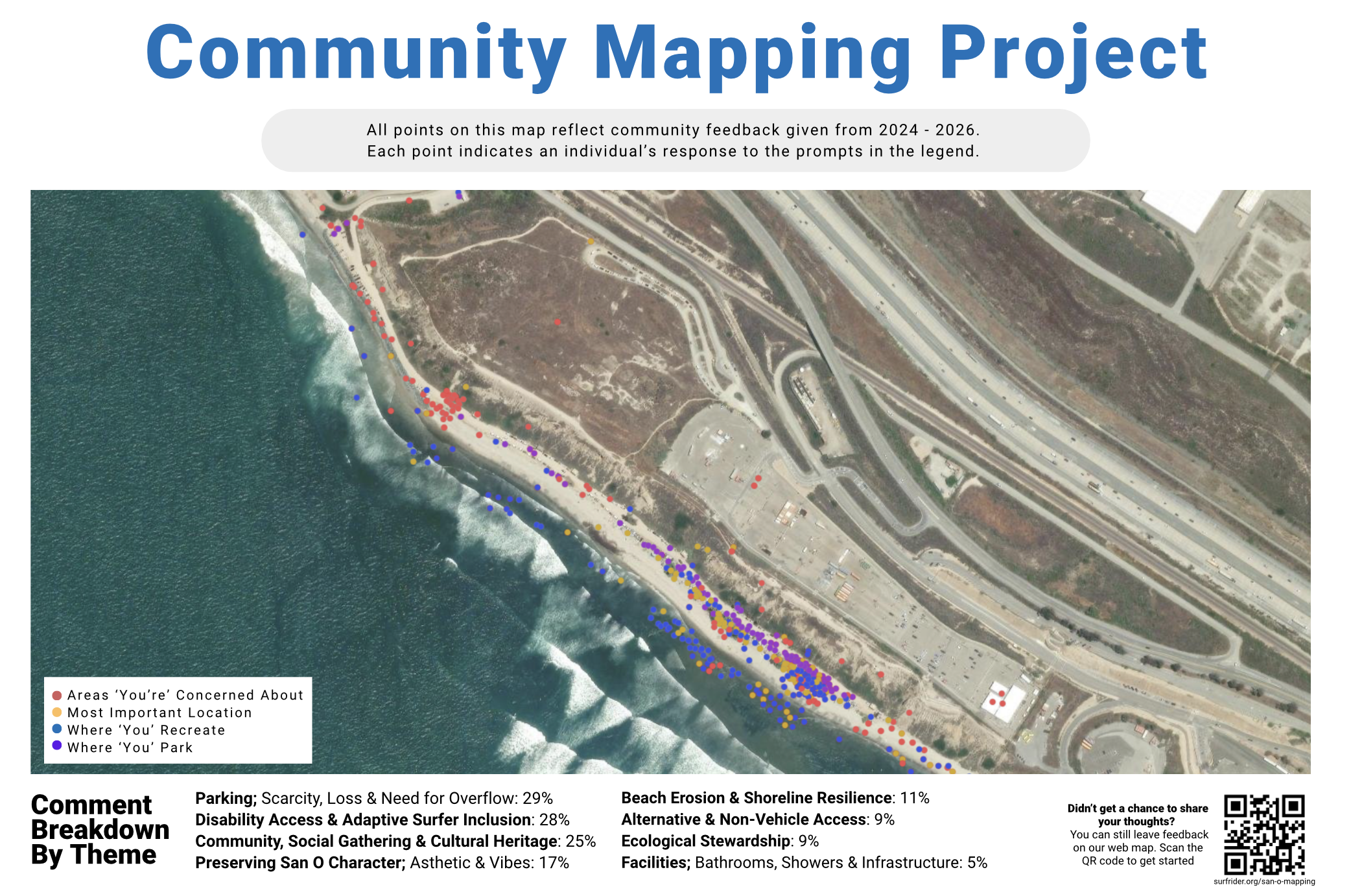
We opened with a station reflecting the community's own words back to them — a word cloud built from your responses since 2024, surfacing the values that keep coming up: access, community, beach, parking, and surf. From there, attendees were given two stickers to show their priorities across the four themes of Parking, Preserving San O Character, Beach Health, and Facilities.
Shoreline & Cobble:
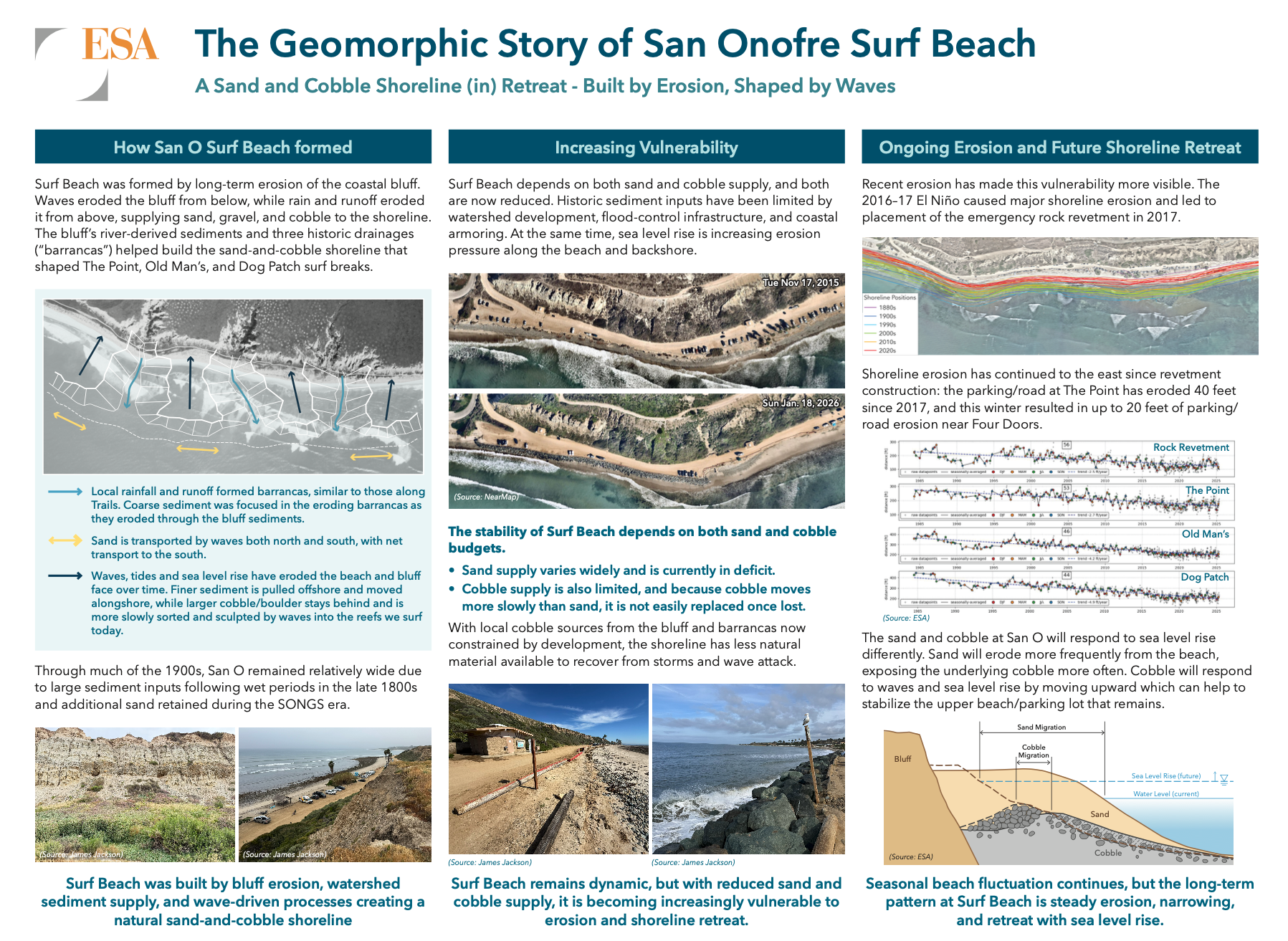
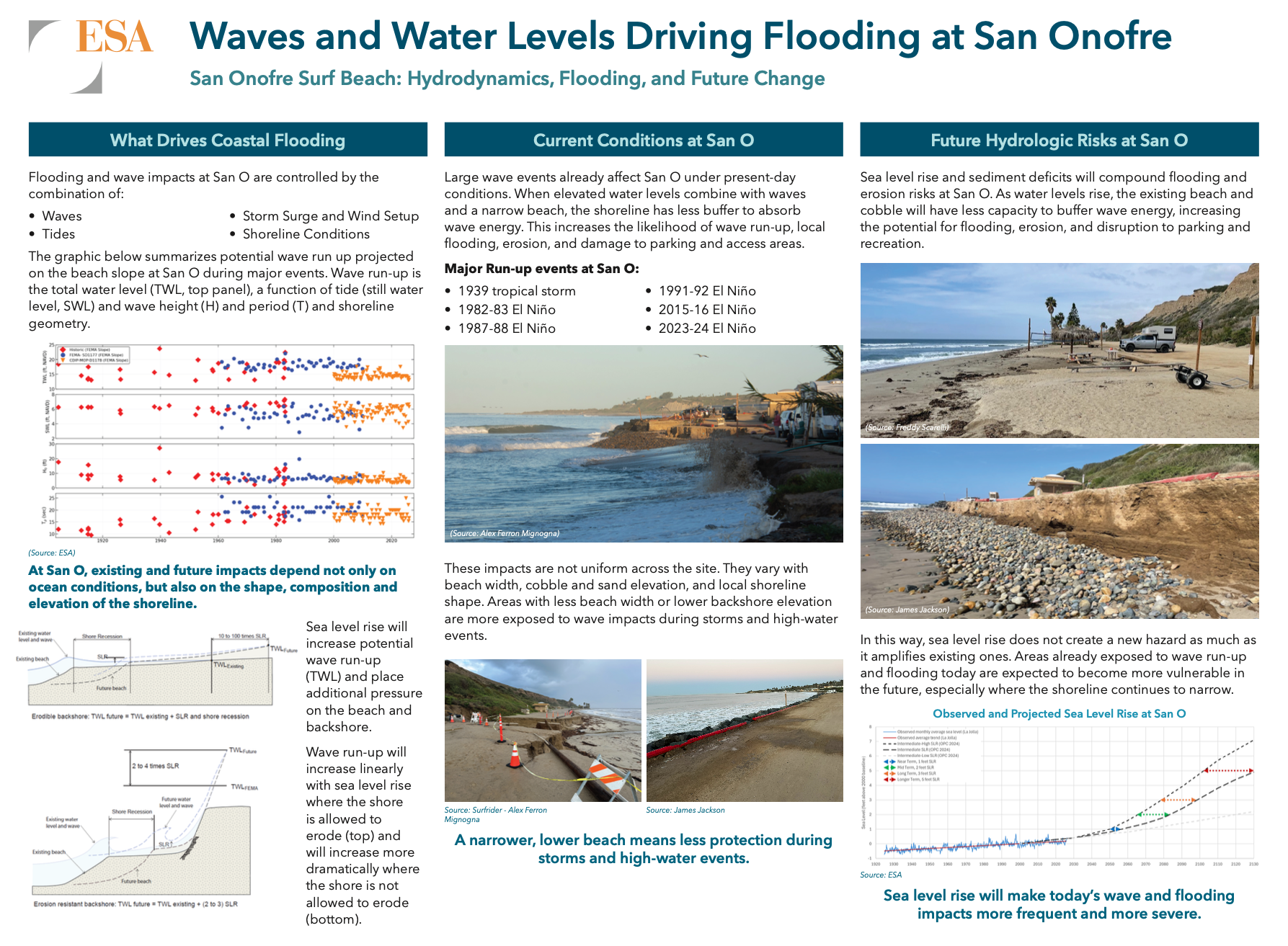
This station explored the history and existing conditions at Surf Beach, including aerial photography, land surveying, geotechnical exploration, historic shoreline dynamics, and new long-term monitoring efforts.
Flooding:
Also informational, here engineers described the current flooding potential at Surf Beach from wave run-up and the possible effects of various sea-level rise scenarios on San O.
Nature-Based Solutions for Surf Beach:
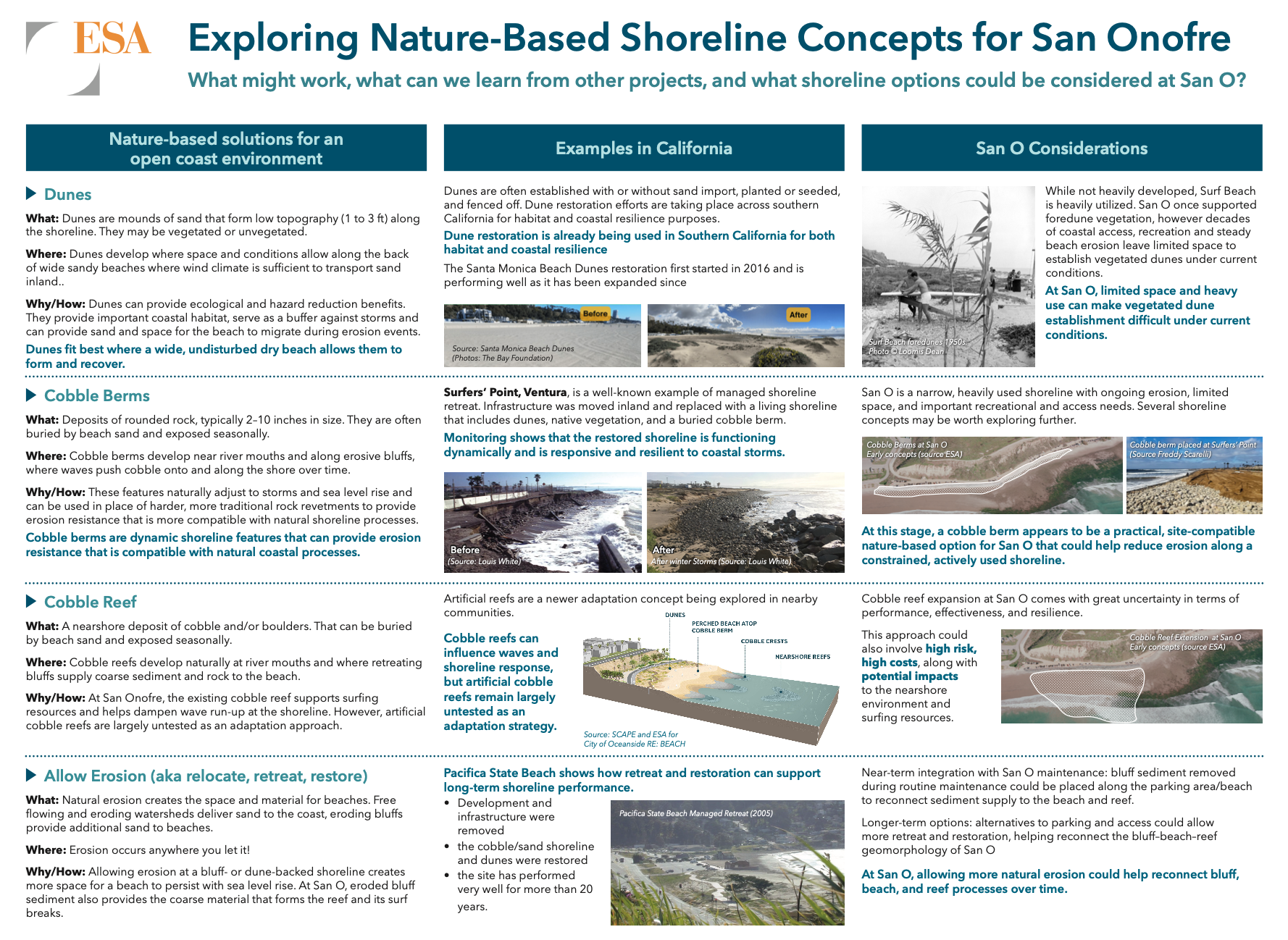
Eagerly awaited, the following was the first look at four high-level potential nature-based concepts our engineering team is evaluating, and their likelihood for success at Surf Beach.
- Dunes
Natural sand formations that buffer wave energy and give the beach room to shift dynamically with seasonal and long term changes to the shoreline.
Dunes are a great option for beaches with enough width to support them, but current conditions and use at San O make the success of dunes alone unlikely. - Cobble Berm
Rounded rock deposits, like what’s already seen at San O, that also shift with storms and wave energy while providing a foundation for sand to build over summer months. This one stood out as practical and site-compatible, with real potential to support the beach along San O's constrained, heavily used shoreline. - Cobble Reef
A nearshore cobble feature that could dampen waves before they hit the beach. While this option offers some promise, it’s untested and could pose risks to surf quality. - Allow Erosion
Allowing for the natural processes to function, reconnecting sediment transportation between bluff and beach. Simple in concept, but would require scraping of the bluff, permittability of
which is unknown.
We asked attendees one open question across all four: What do you think about these options?
Station 5 Immediate-Term: Blufftop Access
While not a direct deliverable for the San Onofre Shoreline Resilience Project, the project team is well aware that before any design implementation takes place (targeted for winter 2027) there is a real risk that access to San O could be interrupted by a road failure or regular intermittent closures due to storms or high tides. So while we have the community together thinking about long-term resilience, we found it important to get feedback on what interim solutions would work best for beach users in the event of a road failure.
Parking:
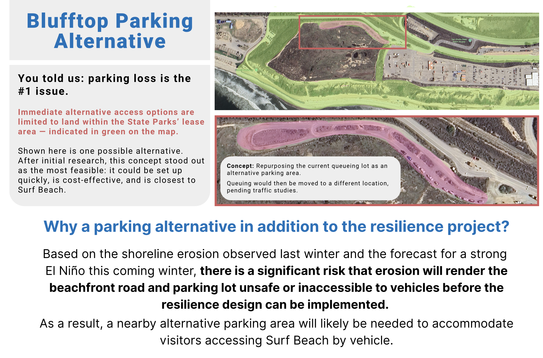
Parking loss has consistently been the #1 concern in community feedback, and with erosion risk rising this winter, we walked through one possible near-term concept: repurposing the current queuing lot as overflow parking, with queuing relocated pending traffic studies. We asked how people get to San O, and whether they'd accept parking elsewhere if it meant more reliable access overall.
Getting to the Beach:
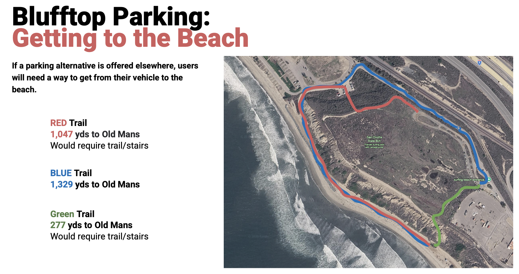
If parking moves to the bluff, people still need a way down. We presented three possible trail alignments — Red, Blue, and Green — each with different tradeoffs in distance and terrain, and asked which alignment, and which vertical access type (staircase vs. switchback trail), felt right to attendees.
Access & Mobility Disabilities:
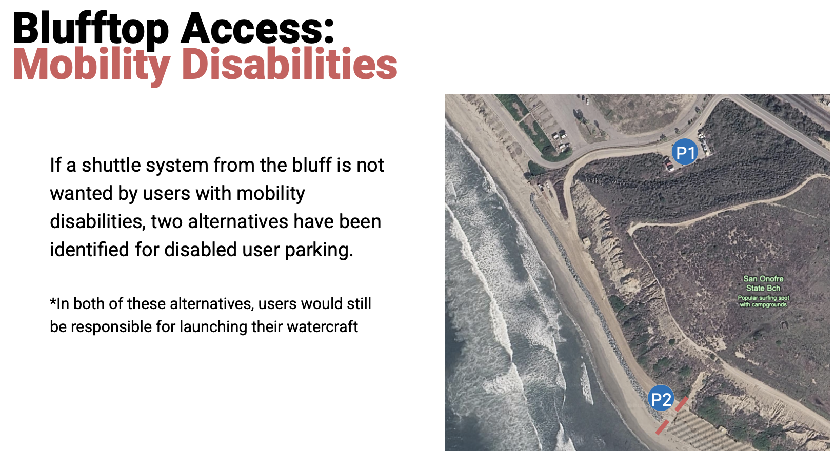
San O has an incredibly robust community of adaptive users and users with mobility disabilities, and stairs or bluff trails don't serve this group. This station built on last year's response to a proposed ADA specific shuttle system, asking instead about preferred parking configurations and what mobility tools or support would actually help people reach the water.
What's Next
Our next Community Assembly, Part 3, is tentatively slated for late summer/early fall of this year. At that meeting our engineering team will present the design recommendation they’ve constructed based on all of the information above.
To keep your finger on the project pulse, you can sign up for project email updates via the form below, or by checking back at our project website.
Stay Updated
If you would like to stay informed and receive updates regarding the San Onofre Shoreline Resilience Project and the state of the beach, simply sign up below.
The San Onofre Shoreline Resistance Project is supported by the California State Coastal Conservancy, in partnership with the Juañeno Band of Mission Indians Acjachemen Nation, California State Parks, San Onofre Parks Foundation, California Indian Culture and Sovereignty Center, Environmental Science Associates, and the San Onofre Surfing Club |





%20-%20600%20x%20600%20px-Aug-04-2026-10-14-09-8931-PM.jpg) As Surfrider's Coastal Preservation Manager, Alex (she/her) focuses on coastal resiliency projects centered around nature-based solutions. She has worked on the ocean as a naturalist and passionately seeks to connect new folks with the sea by linking core memories on the water with education about the impact of marine preservation.
As Surfrider's Coastal Preservation Manager, Alex (she/her) focuses on coastal resiliency projects centered around nature-based solutions. She has worked on the ocean as a naturalist and passionately seeks to connect new folks with the sea by linking core memories on the water with education about the impact of marine preservation.